
Maps are integral to any emergency plan; they visually represent your risk and hazard assessment, reflect preparedness strategies and aid in response.
Emergency mapping involves more than just documenting evacuation routes. It considers the actions and information needed during any incident, inside and outside a building, and throughout all phases of the emergency.
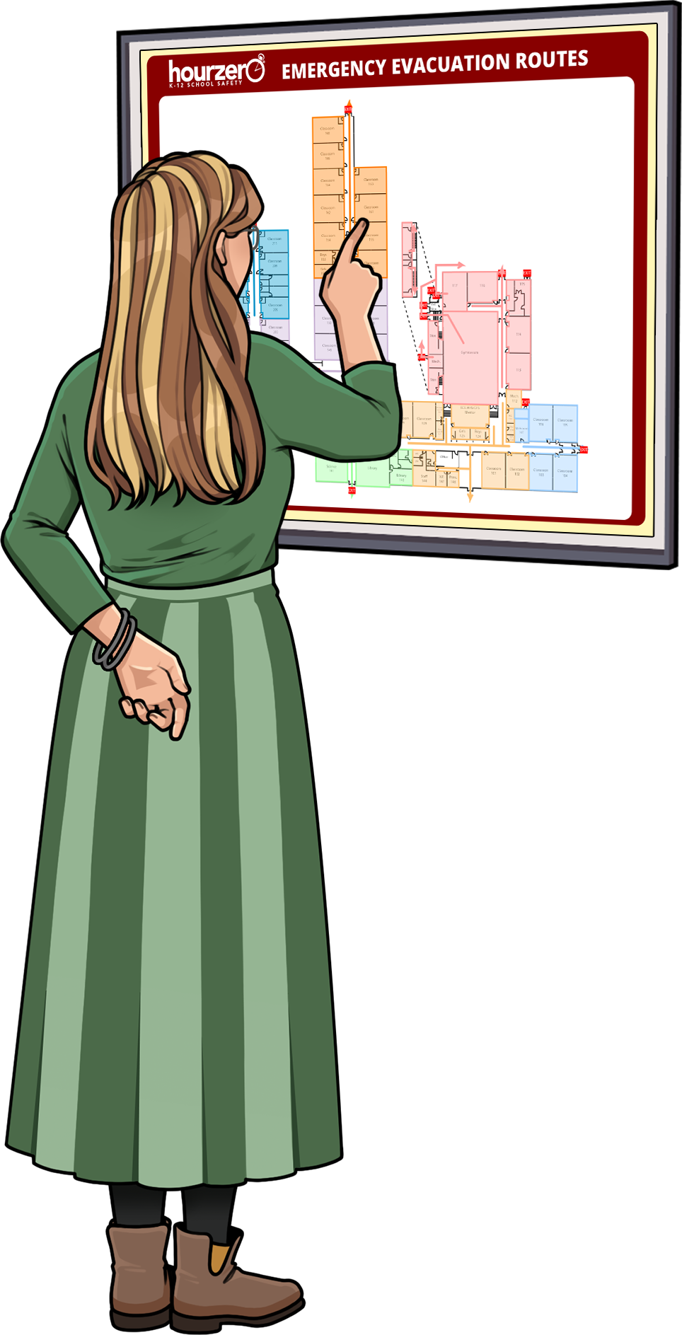
An easy to use mapping tool
No complicated CADs or convoluted processes, just simple, straightforward steps make it possible for even the most novice user to generate good maps.
Specifically engineered for K-12 schools, the HZ mapTool provides distinct features only available in the Hour-Zero mapping systems. With the tool, you can document important details such as lock-down and student release procedures, epinephrine and naloxone storage, and evacuation center locations.
No matter what type of map you want – emergency, maintenance, or room assignments – the HZ mapTool gives you complete freedom to create any map you need, when you need it.
With the HZ mapTool, you can:
- Build protocol-specific maps
- Document over 250 POIs, such as utility controls, roof access, emergency equipment, hazardous materials, camera locations, etc.
- Plot evacuation routes
- Identify areas for lock-downs and shelter-in-place
- Assign staging areas
- Plan Student Release patterns
- Customize maps by combining POIs
- Generate editable Tables detailing each POI location
- Link IP cameras
- Inventory fire protection systems
- Associate digital imagery (including 360°photos), videos, and documents
- Mark maps using symbol library or free-form drawing tools
- Retain data points while replacing outdated building plans
- Share critical information with first responders in a secure environment
- Package pre-authored maps for viewing on any platform or device
- Add and edit text
HZ mapTool puts you in control of your maps.
In-House
The HZ mapTool allows your in-house resources to create and manage your own maps easily. Need to make a change due to construction, that’s no problem! If you want a custom map for a student release procedure, you can create and share one with just a few clicks.
Utilizing the HZ mapTool is a breeze, giving you full control of your maps!
If you decide to go it alone, don’t worry; we are only a click or call away.
HZ Professional Services
When you need an expert or are simply short on time, the team at Hour-Zero has got you covered. We offer emergency mapping services as part of an implementation project, in tandem with risk and hazard assessments, or whenever updates are needed.
Having created school emergency maps for over twenty years, we bring an unsurpassed level of expertise and acute attention to detail.


Hour-Zero takes your risk and hazard assessments, your protocols, and your planning documents to create maps that integrate with your overall emergency program.
Get instant access to HZ mapTool via the web. No need for software, infrastructure or additional hardware. It’s all part of HZ Online.
Discover more industry-leading solutions available from Hour‑Zero.